|
|
|
|
 |
||
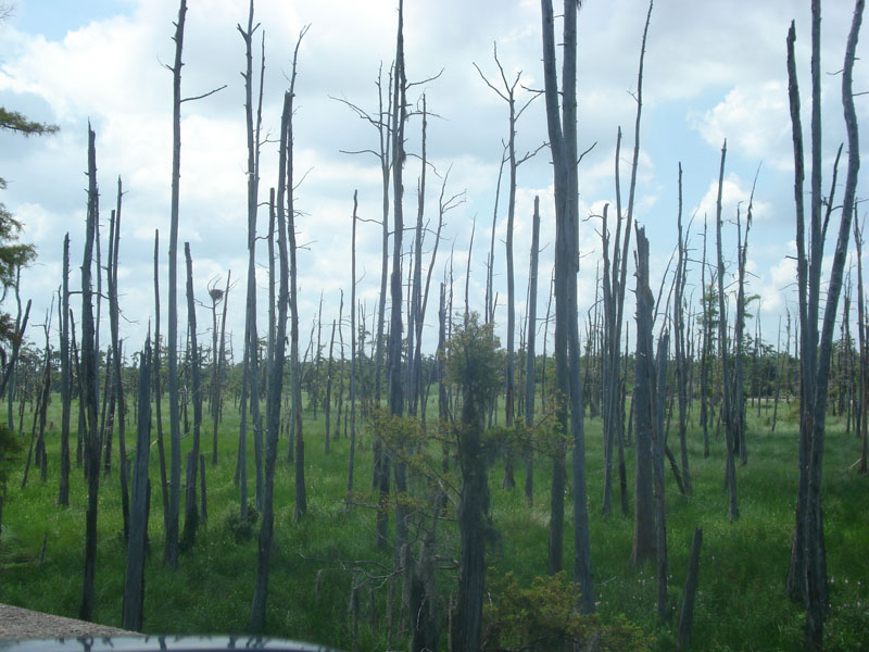
La Branche Wetland

| Image Data | |||
| Date: Direction: State: Country: Marker ID: |
07/30/2011 South Louisiana USA 65 |
||
| Location: | From I-10 west of Kenner | ||
|
|
|
|
Association: Scientist
Longitude: -90.314226
Description: Freshwater Palustrine Forested of dead bald cypress snags. Live bald cypress occupies less than 30% of the cover in the foreground area and Scrub-shrub occupies less than 30% of the cover. Emergent marsh covers most of surface. Some pockets of open freshwater.
 07/30/2011 |
 05/22/2014 |