|
|
|
|
 |
||
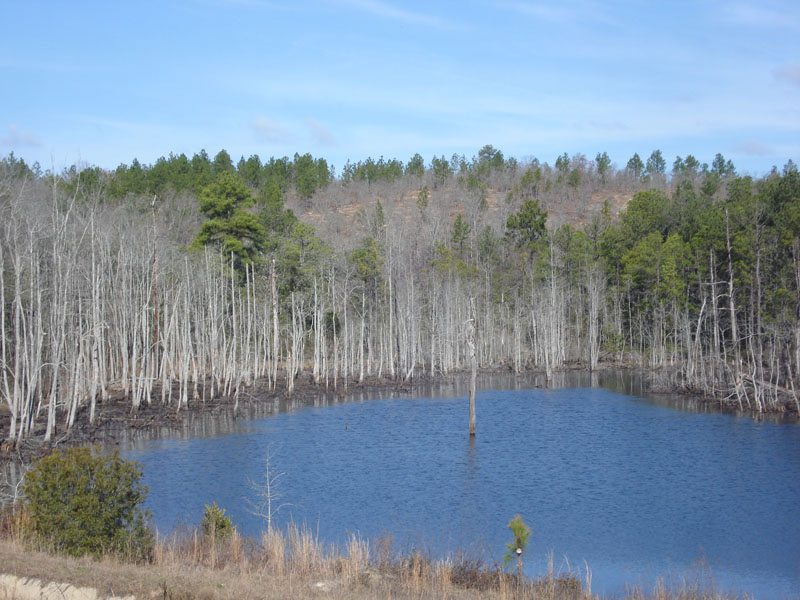
Impoundment near Howard, Georgia

| Image Data | |||
| Date: Direction: State: Country: Marker ID: |
02/20/2012 North West Georgia USA 92 |
||
| Location: | Along Georgia Hwy 98 west of Howard | ||
|
|
|
|
Association: Scientist
Longitude: -84.397166
Description: Impounded palustrine pond permanently flooded, less than 20 acres in size, with dead deciduous forest. The deciduous trees were primarily Ash and Red Maple, although a few scattered dead loblolly pines can be seen.
 02/20/2012 |
 10/29/2016 |