|
|
|
|
 |
||
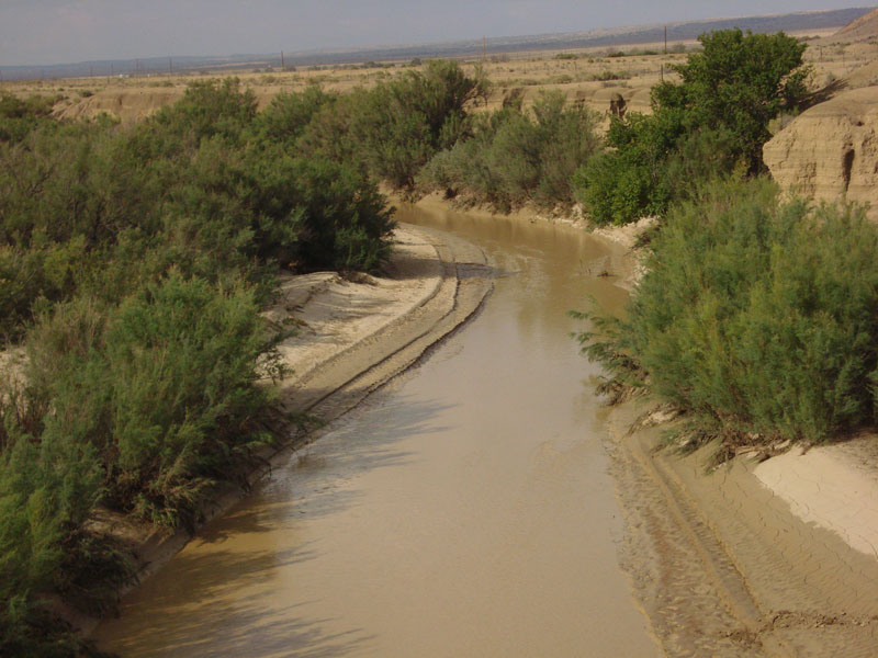
Rio Puerco

| Image Data | |||
| Date: Direction: State: Country: Marker ID: |
08/27/2011 North New Mexico USA 23 |
||
| Location: | Rio Puerco on I-40 | ||
|
|
|
|
Association: Government
Longitude: -106.941599
Description: Rio Puerco Streambed is an intermittently flooded riverine channel during the spring from snow melt and after localized rainstorms. It is a dry streambed for most of the year.
 08/27/2011 |
 12/16/2005 |
 08/04/2017 |