|
|
|
|
 |
||
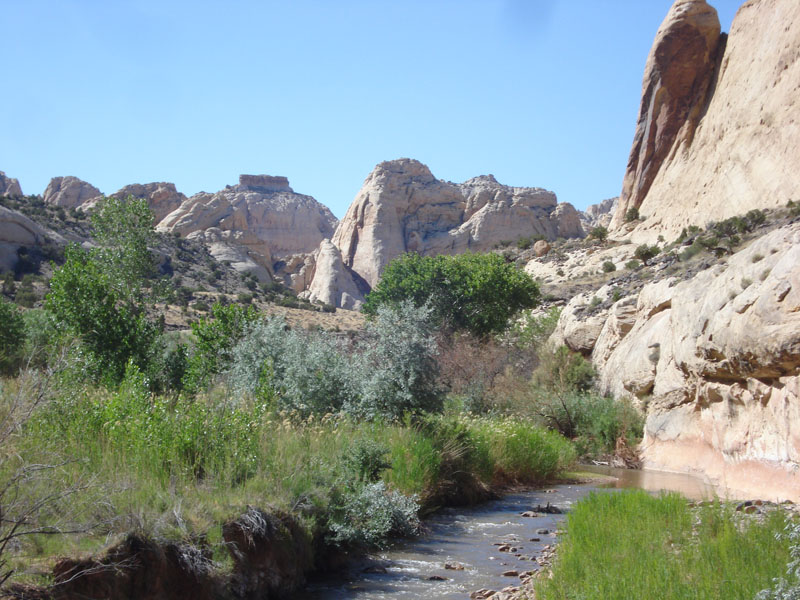
Fremont River

| Image Data | |||
| Date: Direction: State: Country: Marker ID: |
06/22/2012 North West Utah USA 99 |
||
| Location: | Capitol Reef National Park | ||
|
|
|
|
Association: Government
Longitude: -111.191500
Description: Narrow floodplain of the Fremont River is 2 - 3 feet above the stream. Floodplain is vegetated primarily by scrub-shrub, Cottonwoods, Russian Olive, and Sandbar Willow. Some emergent marsh of Three square is on lower saturated sand/gravel bars.
| No Additional Dates for this Site. |