|
|
|
|
 |
||
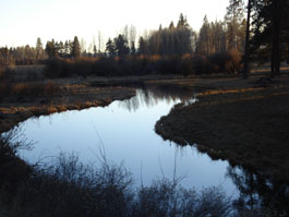
Upper Klamath Basin

| Image Data | |||
| Date: Direction: State: Country: Marker ID: |
10/01/2012 South East Oregon USA 73 |
||
| Location: | South of Ft. Klamath on Hyw 62 | ||
|
|
|
|
Association: Government
Longitude: -121.940807
Description: Meandering stream on edge of relict lake bed. Stream channel flanked by fresh marsh and patches of wetland scrub-shrub.
| No Additional Dates for this Site. |