|
|
|
|
 |
||
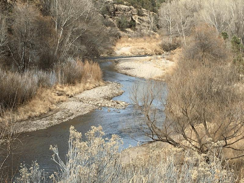
Gila River

| Image Data | |||
| Date: Direction: State: Country: Marker ID: |
03/08/2018 West New Mexico USA 414 |
||
| Location: | Gila Cliff Dwellings National Monument | ||
|
|
|
|
Association: Scientist
Longitude: -108.265729
Description: Floodplain of Gila River dominated by River Birch, Scrub-shrub Sandbar Willow, and scattered emergents. High water mark is well-defined at edge of grass on gravel bars. River had very high flood waters in 2017.
| No Additional Dates for this Site. |