|
|
|
|
 |
||
North Breccia Cliffs

| Image Data | |||
| Date: Direction: State: Country: Marker ID: |
06/16/2017 North West Wyoming USA 407 |
||
| Location: | US Hwy 26 east of Togwotee Pass | ||
|
|
|
|
Association: Scientist
Longitude: -110.105281
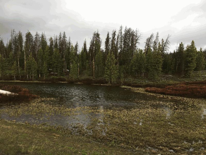
Description: Upper Wind River Basin has a massive debris flow that is active. Gravity is causing the debris to flow downslope aided by winter snow accumulation and liquefaction from snow melt. The pond is one of many occupying depressions within the debris flow lobes. In this shallow depression Emergent Marsh, Wetland Scrub-shrub, and Floating Aquatic Bed are gradually replacing Open Water.
| No Additional Dates for this Site. |