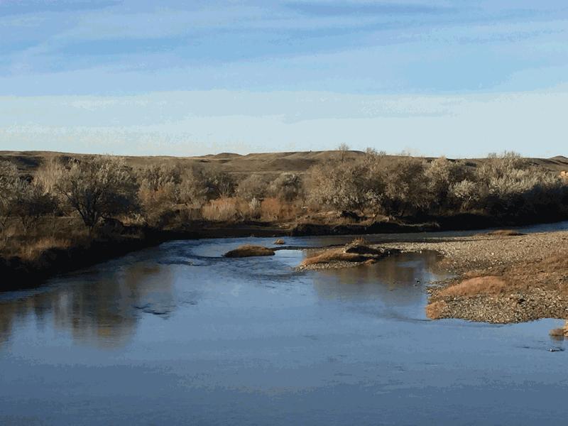
| 
		
		 | 
		  | 
		
		
			Musselshell River 


				| Image Data | 
			 
			
				|   | 
				Date: 
				Direction: 
				State: 
				Country: 
				Marker ID: 
				 | 
				  | 
				11/07/2015 
				North 
				Montana 
				USA 
				337 
				 | 
			 
			
				| Location: | 
				U.S. Hwy 12 east of Melstone | 
			 
		 
		 | 
		  | 
		
	 | 
	
	
		Author(s):
		 Catherine Lockwood 
		Association:
		 Scientist | 
		  | 
				 | 
		  | 
		   Latitude: 46.621521 
		Longitude: -107.822217 | 
	
	
		|   | 
		  | 
		  | 
		  | 
		  | 
	
	
		Wetland Category: Streambed 
		Description: Riverine channel gravel bars; narrow floodplain vegetated with riparian Russian. | 
	
	
		|   | 
	
	
		| Additional Site Dates:  | 


			| No Additional Dates for this Site. | 
		 
				 
		 |