|
|
|
|
 |
||
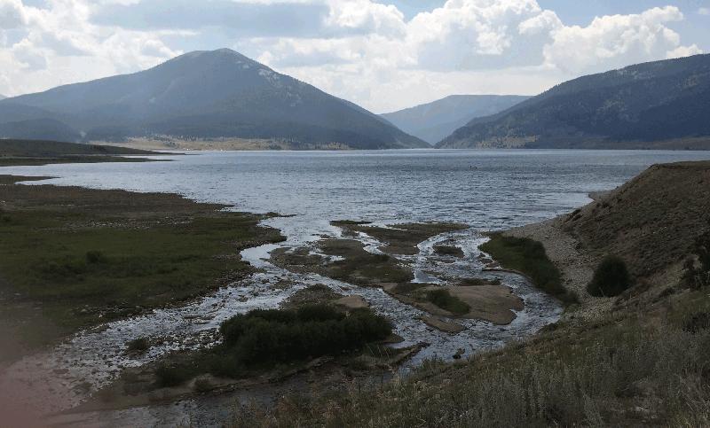
Texas Creek Delta

| Image Data | |||
| Date: Direction: State: Country: Marker ID: |
08/22/2015 South West Colorado USA 310 |
||
| Location: | Taylor Reservoir | ||
|
|
|
|
Association: Scientist
Longitude: -106.562469
Description: Stream has built a delta of gravel and sand into the lake. With the lake level lower, several of the exposed gravel bars are becoming vegetated.
| No Additional Dates for this Site. |