|
|
|
|
 |
||
Alberta Potholes

| Image Data | |||
| Date: Direction: State: Country: Marker ID: |
06/19/2010 North West Alberta Canada 28 |
||
| Location: | East of Hussar on Highway 561 | ||
|
|
|
|
Association: Government
Longitude: -112.392218
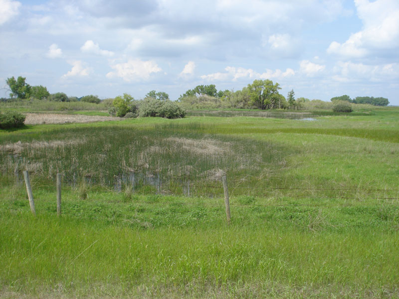
Description: Series of Prairie Potholes in glacial till region of Eastern Alberta. Pothole in foreground is shallow and holds water in spring; it is hayed later in summer. Potholes in background are in various stages of succession with emergent herbaceous vegetation of cattails and spike rush, some open water, and, in the distance, fringing wetland scrub-shrub. The forested areas are on higher knolls adjacent to the potholes.
| No Additional Dates for this Site. |