|
|
|
|
 |
||
| Image Data | |||
| Date: Direction: State: Country: Marker ID: |
08/23/2015 North Colorado USA 278 |
||
| Location: | Lake Fork of the Gunnison River at Gunnison County Rosd 25 | ||
|
|
|
|
Association: Scientist
Longitude: -107.227135
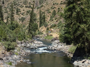
Description: Lake fork of the Gunnison River flows north from the San Juan Mountains to the Gunnison Rive through a deep v-shaped valley. The river bed is bedrock, boulders, and cobble sized material with riparian willow and spruce scrub-shrub growing on the bars and banks.
| No Additional Dates for this Site. |