|
|
|
|
 |
||
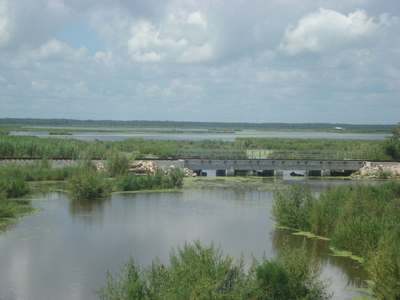
Bayou Piquant

| Image Data | |||
| Date: Direction: State: Country: Marker ID: |
07/30/2011 South West Louisiana USA 21 |
||
| Location: | I-10 West between Kenner and Bonne Carre spillway | ||
|
|
|
|
Association: Informal Educator
Longitude: -90.367441
Description: Looking south across the LaBranch wetlands. A fresh to intermediate marsh. Cypress swamp in the distance, with emergent herbaceous vegetation occupying most of the wetland beyond the railroad grade. Scrub-shrub in the foreground. Duckweed is the green covering on the water. This area has had fluctuations of brackish water from Lake Pontchartrain in the past, with mostly freshwater in recent years.
| No Additional Dates for this Site. |