|
|
|
|
 |
||
Cedar Island Ferry

| Image Data | |||
| Date: Direction: State: Country: Marker ID: |
09/15/2014 North East North Carolina USA 199 |
||
| Location: | Cedar Island Ferry Reserve | ||
|
|
|
|
Association: Government
Longitude: -76.316357
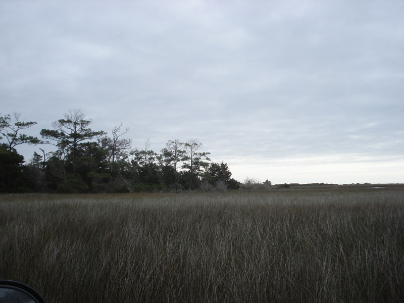
Description: Salt marsh of Spartina and Juncus dominate. Wetland Scrub-shrub at edge of upland has been impacted by Hurricane Sandy in 2012 and Hurricane Arthur in 2014 with saltwater intrusion stressing and killing the Wax Myrtle. The upland pines have been affected by the hurricane winds by being stripped of needles and branches in their upper reaches.
| No Additional Dates for this Site. |