|
|
|
|
 |
||
| Image Data | |||
| Date: Direction: State: Country: Marker ID: |
09/28/2005 North East Arkansas USA 146 |
||
| Location: | Louisiana Purchase Survey Marker | ||
|
|
|
|
Association: Government
Longitude: -91.052450
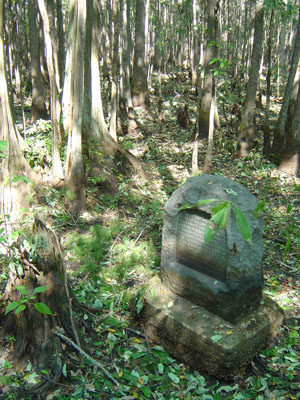
Description: Headwater Swamp, Forested Wetlands dominated by Water Tupelo and a few Bald Cypress. Swamp is dry in September because of dry summer, but soil is saturated to the surface. Marker is the location of the intersection established in November 1815 of the Baseline and the 5th Principal Meridian used for the Louisiana Purchase land survey.
| No Additional Dates for this Site. |