|
|
|
|
 |
||
| Image Data | |||
| Date: Direction: State: Country: Marker ID: |
04/22/2008 South East Arkansas USA 11 |
||
| Location: | Lower White River National Wildlife Refuge | ||
|
|
|
|
Association: Government
Longitude: -91.109619
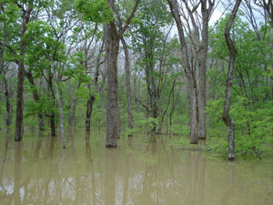
Description: Forested Wetland in the White River floodplain. The bottomland hardwood forest consists of Green Ash, Water Hickory, and Overcup Oak. Water depth on the floodplain is about 11 feet from the spring flooding.
| No Additional Dates for this Site. |